
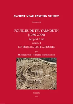
Fouilles de Tel Yarmouth (1980-2009). Rapport final. Volume 1
Final Report On The Excavations Of The Tel Yarmuth Acropolis, Israel
FINAL REPORT ON THE EXCAVATIONS OF
THE TEL YARMUTH ACROPOLIS, ISRAEL
ENGLISH SUMMARY*
1. GENERAL INTRODUCTION
1.1. The Site
1.1.1. Situation
Tel Yarmuth is located at a distance of 34 km inland from the coast of the Mediterranean
Sea and 25 km south-southwest from Jerusalem, in a region of low hills called in the Bible
the Judean Shephelah, or lowland of Judea (Fig. 1.1). It is a fertile region connecting, by
transversal and longitudinal roads, the Coastal Plain, the Judean Hills, the northern and
the southern Shephelah ( Figs 1.2–1.7).
The area around Tel Yarmuth has witnessed since 1989 until this day large scale cam-
paigns of surveys and salvage excavations conducted by the Israel Antiquities Authority
in the framework of the urban project of Ramat Beth Shemesh. This new settlement – a
satellite of the town of Beth Shemesh – has already expanded to the eastern fringe of the site
and will ultimately cover the hills to the south and the west of it. Consequently, this region
of the Shephelah is now archaeologically one of the best documented in Israel, with an
archaeological map showing a dense network of sites from the Chalcolithic to modern times
(Fig. 1.3). For the Bronze and Iron Ages, the main sites are Tel Beth Shemesh, Tel Zanoah
and Khirtbet el-‘Alya to the north of the site and Tel Azekah, Khirbet Qeiyafa and
Tel Socoh to the south. Tell es-Safi is only 12 km to the west, on the border of the Coastal
Plain.
1.1.2. Topography
Tel Yarmuth covers nearly 18 ha and is one of the largest archaeological sites of the inner
Shephelah. Triangular in shape, with a maximal length of 640 m and width of 400 m, it is
comprised of two distinct topographical units, the upper city or acropolis, which occupies
the apex of the triangle, and the lower city ( Figs 1.8–1.10). The acropolis culminates
at 405 m, more than 100 m above the lowest point of the lower city. It is composed of
two successive terraces ( Figs 1.11–1.14): a lower terrace, oval in shape, is bordered by the
contour line of 395 m and covers c.1.5 ha; and an upper terrace, rectangular in shape,
delimited by the contour line of 404 m.
* This summary focuses on chapters 1–3 and 24.
570 ENGLISH SUMMARY
1.2. The Acropolis of Yarmuth
1.2.1. Early researches
Thanks to the topographic information given in the Onomasticon of Eusebius of Caesarea
(On. 106,9 and 24), the approximate location of Yarmuth has been registered on the earliest
maps of the Holy Land compiled during the Renaissance. Its exact location was identified by
E. Robinson and E. Smith in 1838, who mentioned the site as Khirbet el-Yarmuk, a toponym
which designates only the acropolis and became henceforth canonical on geographical maps.
The first visitor to the acropolis was T. Tobler in 1857, who left a remarkably detailed descrip-
tion of its surface remains, followed by V. Guérin in 1863, who reiterated Robinson and
Smith’s identification of the site with Eusebius’ Iermochos, and hence with biblical Yarmuth.
The site was then regularly visited by several generations of scholars who knew only the
acropolis, the Khirbet el-Yarmuk stricto sensu, and were not aware of the existence of the
lower city. The latter was identified only in 1960 during a surface survey conducted by A.
Druks. Following this discovery, a season of excavations was conducted in 1970 by A. Ben-
Tor on behalf of the Hebrew University of Jerusalem. These first excavations concerned only
the lower city but, thanks to sherd collections on the acropolis, the sequence of occupation
of the entire site was established in broad lines. It showed that after the total abandonment
at the end of the EB III, the lower city was never resettled; reoccupation of the site took
place only on the acropolis. However, the sequence of occupation of the upper city could not
be established in detail. In particular, Ben-Tor’s surface collection failed to reveal an occupa-
tion dating to the LB II, the supposed period of Joshua’s “conquest”. It was clear that the
issue of the site’s biblical identification could not be solved without systematic excavations.
Excavations at Yarmuth were renewed in 1980 under the direction of P. de Miroschedji
on behalf of the Centre de recherche français à Jérusalem (CNRS and Ministère des Affaires
étrangères), in the framework of a research program focused on the Early Bronze Age. They
concentrated therefore on the lower city. However, it was decided in 1986 to extend the
excavations to the acropolis in order to establish the post-Early Bronze Age sequence of
occupation of the site.
1.2.2. The surface survey in 1986
Prior to these excavations, a systematic survey of the upper city was conducted by A.
Lemaire in 1986. It resulted in a host of detailed observations on the remains (buildings,
cisterns, caves, a quarry, tombs) visible on the surface of the hill and its immediate vicinity
( Figs 1.11–1.19), confirming the presence of the ruins of a Late Roman-Early Byzantine
settlement probably to be identified with the village of Iermochos mentioned by Eusebius.
The presence of thick walls surrounding the two superimposed terraces forming the acropo-
lis was also noticed. They determined the location of two excavated soundings.
1.3. The Excavations on the Acropolis
Leaving aside the northeastern part of the acropolis, where the remains of the Late Roman-
Early Byzantine village are concentrated, the soundings were implanted on the southwestern
FINAL REPORT ON THE EXCAVATIONS OF THE TEL YARMUTH ACROPOLIS, ISRAEL 571
slope, respectively on the edge of the lower terrace (Sounding 1) and of the upper terrace
(Sounding 2) (Figs 1.11–1.13). They were situated along the same line in order to provide
a comprehensive section of the topography and the stratigraphy of that side of the hill from
bedrock to surface (Fig. 1.20; Table 1.1):
– Sounding 1 was implanted in squares AR–AS 116 and excavated under the supervision
of André Lemaire in 1986 and 1987. It reached eventually 27 sq. m and reached bedrock
at a depth of 5.5 m below the surface.
– Sounding 2 covers five squares, that is, nearly 100 sq m. It was excavated in 1987,
1989 and 1990 under the supervision of André Lemaire and, after five years of interruption,
in 1996 and 1997 by Michaël Jasmin. The maximum thickness of the archaeological strata
is here 6.70 m above bedrock. The slope in squares AZ–BA 116 is especially steep, with
a difference in level of 5 m on a distance of 10 m.
2. SOUNDING 1
The initial goal of the sounding was to verify whether the steep slope encircling the lower
terrace corresponds to a fortification wall, presumably of the Iron Age. The excavation did
indeed recover a city wall (M.1108), but dating to the Early Bronze Age.
2.1. Stratigraphic sequence
The excavations did not encounter occupation strata stricto sensu, but rather phases of
construction and use, labeled Phase Acr-1 to Acr-6 (in arabic numerals, in order to distin-
guish them from the occupation strata identified in Sounding 2), from bottom to top
(Figs 2.1–2.2; Table 2.1). Phases Acr-1 to Acr-4 correspond to well-stratified layers dating
to the EB II–III, earlier than and contemporary with Wall 1008. Phase Acr-5 marks a long
period of erosion and yielded sherds dating from the LB IIB to the Persian period. Phase
Acr-6 dates mostly to the early centuries of our era, when terrace walls were built on the
periphery of the Late Roman–Early Byzantine settlement.
2.2. The Phases
– Phase Acr-1 is marked by the establishment of a glacis represented by several layers of
terra rossa, huwwar and small stones (L.1124 + 1123). It was probably associated with
a fortification wall located uphill, outside of the sounding limits. These layers were practi-
cally sterile, except for a few EB II sherds (Fig. 4:1–3).
– Phase Acr-2 represents a second stage of the glacis (L.1121).
– Phase Acr-3 witnessed the construction of a fortification wall (M.1008) with cyclopean
masonry on the outer face, which cuts partly through the earlier glacis (Figs 2.3–2.6).
Some remains of this wall can be traced on the surface to the southeast, and especially to
the north of the acropolis ( Fig. 1.17).
– Phase Acr-4 corresponds to the use of Wall 1008, marked by a succession of layers
and floors (Figs 2.7–2.9). The earliest (L.1115) dates to the EB II–III, while the others 572 ENGLISH SUMMARY
(L.1111–1109) have yielded sherds dating to the EB IIIA (Figs 4.3:1–9, 4.4:10–18), as
well as a basalt bowl (Fig. 15.6:1) and a fragment of an Egyptian offering table (Fig. 17.1).
– Phase Acr-5 corresponds to a period of abandonment of the site: L.1106 is an erosional
layer which contained a large amount of EB IIIA pottery (Fig. 4.4:1–9), and only 2 per
cent of later sherds (LB, Iron Age I and Persian) found close to its top.
– Phase Acr-6 is marked by the installation of several terrace walls associated with late fills,
in which Iron Age IB (Fig. 9.5), Hellenistic (Fig. 12.1) and mostly Roman sherds
(Fig. 12.2) were found.
2.3. Interpretation of the sequence
The most important discovery made in Sounding 1 concerns the Early Bronze Age forti-
fications. Wall 1108 presents the same characteristics as Wall B in areas A and D of the
lower city (Fig. 2.10). Thus, this wall encircled the entire site, lower and upper city together.
It also cuts into an earlier glacis which, in the lower city, is associated with Wall A, the first
city-wall. It is therefore assumed that Wall A exists also on the acropolis, but is yet unexca-
vated uphill from Sounding 1.
3. SOUNDING 2
The goal of the sounding was to obtain, by means of a stratigraphic step trench implanted
on the edge of the upper terrace, a general view of the sequence of occupation of the upper
city (Figs 3.1–3.2).
3.1. Preliminary remarks
The stratigraphy of Sounding 1 is illustrated by several sections (see Fig. 3.3), both longi-
tudinal (Figs 3.4–3.5, 3.6–3.8 ; Dépliants 1–2) and transversal (Figs 3.9–3.10, 3.11–3.12).
They show the succession of nine archaeological strata, labeled in roman numerals from top
to bottom Acr-I to Acr-IX, from the Romano-Byzantine period on the surface to the EB II
on bedrock. Because of the location of the sounding on a steep slope, the preservation of the
architectural remains is generally poor due to the intense erosion (especially during periods
of abandonment), the establishment of late terrace walls and the presence of large and deep
pits.
Being the most complete, the southeastern longitudinal section ( Fig. 3.4 ; Dépliant 1)
has been chosen as the section of reference for the illustration of the stratigraphy and
structures of Strata Acr-IX to Acr-I.
3.2. Stratigraphic sequence
The stratigraphic sequence shows four major phases of occupation separated or not by
interruptions (Table 3.1 ):
– Strata Acr-IX to Acr-VII: These three strata date to the EB II–III and represent a con-
tinuous occupation, contemporary with Phases Acr-1 to 4 in Sounding 1 and with the
FINAL REPORT ON THE EXCAVATIONS OF THE TEL YARMUTH ACROPOLIS, ISRAEL 573
Early Bronze Age strata in the lower city (Tables 1.1 , 2.1). Tel Yarmuth was then aban-
doned until the reoccupation of the acropolis in the MB II.
– Strata Acr-VI to Acr-III: Omitting the comparatively few MB II sherds ascribed to
Stratum Acr-VIB, these four strata date to the last third of the second millennium BCE.
They illustrate a continuous occupation over three archaeological periods: the LB IIB
(13th cent.: Stratum Acr-VIA); the LB III/Iron IA (mid-12th cent.: Stratum Acr-V) and
the Iron IB (end of 12th cent.: Stratum Acr-IV; 11th cent.: Stratum Acr-III).
– Stratum Acr-II: From Iron IIA to Persian period.
– Stratum Acr-I: Hellenistic to Roman period.
The site seems to have been deserted twice – between the EB III and the MB II, and
between the MB II and the LB IIB – and to have been sparsely occupied during the MB II,
Iron IIA–B and the Hellenistic period.
3.3. Strata Acr-IX to Acr-VII (EB II–III)
Evidence of the Early Bronze Age settlement was brought to light in square AZ 116 in
reliable stratigraphic conditions (Figs 3.13, 3.14–3.19):
– Stratum Acr-IX marks the earliest occupation immediately above bedrock. It is repre-
sented by four layers and three floors (L.2315, L.1998-4–5) with no architectural remains.
Given the small size of the exposure, the pottery is fairly abundant and dates to the EB II
( Figs 4.5–4.6).
– The first building remains appear in Stratum Acr-VIII. The walls have foundation
trenches and one of them is built with a single row of stones, an unusual feature for this
period. The corresponding floors (L.1198-b and a) have yielded abundant pottery dated
to the EB IIIA ( Figs 4.7–4.8), together with a fragment of a figurine or of a votive bed
( Fig. 15.2).
– No building remains are connected with Stratum Acr-VII, which was partly erased by the
Early Roman installation of Stratum Acr-IB. Stratum Acr-VII is represented by two floors
(L.1191-a and b) above the walls of the preceding strata. They were associated with frag-
ments of a tabūn (Fig. 3.20) and abundant pottery of EB IIIB date (Fig. 4.9).
In squares BA–BB 116, no in situ Early Bronze Age occupation was found, although
the pottery of that period is abundant, mixed with MB II and LB IIB sherds, in the bottom
layers of L.1173. This pottery is mostly of EB IIIB date (Figs 4.10–4.11).
3.4. Stratum Acr-VI (MB II and LB IIB)
A sounding (L.1173) excavated in squares BA–BB 116 on a depth of 2.0 m to 2.4 m
from Stratum Acr-V down to bedrock did not encounter any building remains (Figs 3.21,
3.22–3.27). The five layers of this locus all contained a mixture of Early, Middle and Late
Bronze Age sherds, although the bottom layers (1173-5 and 4) held mostly EB III and some
MB II sherds and the top layers (1173-3 to 1) almost exclusively LB IIB sherds. Since no
objective stratigraphic distinction could be made between the pottery of these three periods,
the EB III pottery has been ascribed empirically to Stratum Acr-VII, the MB II pottery to
574 ENGLISH SUMMARY
a “Stratum” Acr-VIB and the LB IIB pottery to a “Stratum” Acr-VIA. This odd strati-
graphic situation is probably to be explained by the fact that the site lay deserted, and
eroded, between the Early and the Middle Bronze Age; that it was only sparsely settled
in the MB II; and that in the LB II, this area was probably at the periphery of the main
settlement.
The pottery ascribed to Stratum VIB and testifying to a MB II occupation is meager but
typical of the period (Figs 5.1–5.2). That ascribed to Stratum VIA is quite abundant and
characteristic of the LB IIB (Figs 7.3–7.8). It includes imported Cypriot (Figs 7.3:5,
7.7:17–18) and Mycenaean IIIB wares (Figs 7.5:6,16–17, 7.7:14).
3.5. Stratum Acr-V (LB III/Iron IA)
The earliest building remains of this stratum rest directly on top of the last surface of
Stratum Acr-VI. The walls are all built with one single row of stones, as those of the follow-
ing Strata Acr-IV and III, and with the same orientation. They are erected on two levels
separated by wall 1189 ( Figs 3.28, 3.29–3.32). Two sub-strata were distinguished, VB and
VA. Stratum Acr-VB is represented by an open space (L.2309A) and two rooms, L.2307
and L.2310, the latter containing a tabūn (Figs 3.29–3.31). New floors and the construc-
tion of wall 1151 mark Stratum Acr-VA. The associated L.1186 has yielded a Late Rames-
side scarab (Fig. 18.1) and abundant pottery of LB III/Iron IA date (Figs 8.6–8.13). There
is no imported ware, although a cooking-jug of Philistine appearance is worth mentioning
( Fig. 8.9:10).
3.6. Stratum Acr-IV (Iron IB)
Stratigraphy suggests a smooth transition from Stratum Acr-V to Acr-IV, whose build-
ing remains appeared in squares BB–BC 116 (Figs 3.33, 3.34–3.39). They are distributed
on both sides of a transversal wall (1154/2341) separating two levels. In the lower level
(square BB 116), the debris above floor 1150-a was not more than 0.30 m thick. In the
upper level (square BC 116) an enigmatic structure (2327) was found, possibly a kiln of
some sort, limited by a semi-circular wall and containing two rounded cavities set side by
side. The pottery associated with this structure and with L.1150 is typical of the early
Iron IB period (Figs 9.6–9.8) and marks the appearance of Philistine Bichrome Ware
(Philistine 2) (Fig. 9.7:1–8). Noteworthy from this stratum is also a fragmentary toggle-
pin (Fig. 14.1:5).
3.7. Stratum Acr-III (Iron IB)
In direct stratigraphic succession with the preceding stratum, Stratum Acr-III has revealed
the best preserved and coherent building remains excavated in Sounding 2 ( Figs 3.40, 3.41–
3.52). Given the small size of the excavation, no complete building plan was uncovered.
The building remains are those of domestic houses erected on a slope with several terraces.
Two long longitudinal walls (1138, 1133) follow the slope and are linked to a series of trans-
versal walls which act as small terrace walls, isolating several spaces.
FINAL REPORT ON THE EXCAVATIONS OF THE TEL YARMUTH ACROPOLIS, ISRAEL 575
The occupation of this stratum ended with a violent conflagration marked by a
one-metre-thick destruction layer. Consequently, abundant archaeological material was
recovered in situ, including 25 storage jars, bowls, craters, cooking pots, jugs, juglets
and lamps (Figs 3.43–3.47, 3.50–3.52), which represents a comprehensive assemblage of
late Iron IB vessels (Figs 10.12–10.22), including Philistine Bichrome Ware (Philistine 2)
(Figs 10.12:8–9, 11 ; 10.13:5 ; 10.17:12 ; 10.20:14–15). Another fragmentary toggle-
pin also came from this stratum ( Fig. 14.1:4).
A hoard of Ramesside Egyptian bronzes discovered in the lower city was probably hidden
there at the time of Strata Acr-IV/III (see chapter 19) and is for this reason incorporated into
this report. It comes most probably from the looting of an Egyptian temple following the
destruction of Lachish Level VI – a city contemporary with Stratum Acr-V (see Table 24.1 ).
3.8. Stratum Acr-II (Iron II to Persian)
The remains ascribed to Stratum Acr-II were brought to light only in squares BB–BD 116
(Figs 3.53, 3.54–3.58). Two substrata were distinguished, Acr-IIB and Acr-IIA. The former
is represented by two thick perpendicular walls uncovered in the uppermost square BD 116.
Built over the leveled remains of the preceding stratum and 1.7 m high, they are the foun-
dations of a large fortress-like building which covered the top of the hill. There are no
associated floors preserved, only layers of fill inside (L.2319) and outside (L.2320). The
pottery from L.2320 dates mainly to the Iron IB and IIA ( Figs 11.3–11.7) and includes the
Late Philistine Ashdod Ware ( Fig. 11.7:7). Stratum Acr-IIA is represented in square BB 116
by a thick terrace wall (M.1118A) associated with a plastered floor (L.1140) and a later
layer of fill (L.1119). Both have yielded Iron Age IIC and Persian pottery (Fig. 11.8), in
addition to a Persian fibula ( Fig. 14.1:6) and a stamp seal in steatite (Fig. 16.1).
One of us (M. J.) interprets Stratum Acr-IIB as corresponding to the remains of an Iron
Age II fortress-like construction, with wall 1118A as a later addition. The other (P. de M.)
sees only one stratum dated to the Iron Age IIC – Persian period consisting of a fortress-like
building with an external terrace wall, L.2320 being a fill containing mixed material.
3.9. Stratum Acr-I (Hellenistic, Early Roman, Late Roman–Early Byzantine)
Three sub-strata, IC to IA, were distinguished among the remains of the latest phases of
occupation. Deep pits (F.1174, F.1190) and a subsequent erosion (L.1117B) are ascribed to
Stratum Acr-IC and could date to the Hellenistic period. Stratum Acr-IB was isolated in
square AZ 116, where a deep terrace wall (M.1167B) has cut through all preceding strata
down to the top of the Early Bronze Age Stratum Acr-VII ( Figs 3.4, 3.6, 3.9), in order
to create a terrace on which a Roman house, with an attached cistern, was established
(Figs 3.59, 3.60–3.64). The associated pottery is Early Roman (Fig. 12.3:7–16).
To the last stratum, Acr-IA, are ascribed a series of terrace walls built in succession along
the slope ( Figs 3.65, 3.66–3.71; pottery on Fig. 12.3:1–6). They were located at the
periphery of the latest village of Yarmuth which occupied the top of the hill and its northern
and northeastern slopes (Figs 1.11–1.19, 3.72–3.77). The site was subsequently abandoned
and never resettled.
576 ENGLISH SUMMARY
24. GENERAL CONCLUSION: CHRONOLOGICAL, CULTURAL AND HISTORICAL SYNTHESES
Being the only part of the site occupied during all periods when a human presence is
attested at Tel Yarmuth, the sequence of occupation of the acropolis reflects that of the site
in general, lower and upper city together. Hence, the results of the excavations allow the
main lines of the history of occupation of the site to be traced and contribute to clarify its
archaeological, historical and biblical contexts.
24.1. History of Occupation of the Acropolis of Yarmuth
The sequences of stratified deposits identified in the acropolis Sounding 2 are represented
in Tables 1.1, 3.1, 24.1–24.2 and in Figs 24.2–24.3.
24.1.1 to 24.1.4. From the Early Bronze Age (Strata Acr-IX to Acr-VII) to the Late Bronze
Age IIB (Stratum Acr-VIA)
During the Early Bronze Age, the acropolis was only a small part (1.5 ha) of a huge site
(18 ha), one of the major city-states in the southern Levant. It has witnessed a continuous
occupation in the EB II–III. The absence of sherds dated to the EB IB, a period well
attested in the lower city, does not necessarily imply that the upper city was then unoccu-
pied since erosion may have erased its remains. A major discovery in Sounding 1 is that of
the Early Bronze Age fortifications which encircled the entire settlement.
The excavations of both the acropolis and the lower city testify that the site was entirely
abandoned during the Early Bronze-Middle Bronze Age period. However, this abandon-
ment did not affect the surrounding area since several small sites dated to that period are
known in the vicinity of Tel Yarmuth, in addition to a cemetery excavated at Khirbet
el-‘Alya.
A few sherds found in erosional layers indicate with certitude that Tel Yarmuth was reoc-
cupied in the MB II, but nothing is known about the nature and extent of this settlement.
It was probably small and perhaps ephemeral, as in other nearby hamlets (Khirbet el-‘Alya,
Socoh, Khirbet Qeiyafa) existing then in the shadow of Tel Azekah ( Figs 24.1–24.2).
Tel Yarmuth seems to have been deserted in the LB I and LB IIA periods. Stratum Acr-
VIA marks the reoccupation of the site which was then incorporated in the network of LB
IIB settlements of the Shephelah (Table 24.1). Together with some other nearby settle-
ments (Khallat el-Himara, Khirbet el-‘Alya), it was probably under the domination of Tel
Azekah (Figs 24.1 –24.3) and was therefore in contact with the Coastal Plain from where
Cypriot and Mycenaean wares were imported.
24.1.5. The Iron I (Strata Acr-V to Acr-III)
There is a smooth stratigraphic transition from Stratum Acr-VIA to Stratum Acr-V,
which inaugurates the Iron Age I and a long period of prosperity which appears to have
lasted until the end of Stratum Acr-III.
FINAL REPORT ON THE EXCAVATIONS OF THE TEL YARMUTH ACROPOLIS, ISRAEL 577
24.1.5.1. Character of the Iron Age I period at Tel Yarmuth
Cultural, and probaby also ethnic, continuity characterize the evolution of the site during
this lapse of time. The persistence of Canaanite traditions in the treatment of pottery
surfaces, notably buff slips and painted decorative motifs, is noteworthy. Red slip hand
burnishing makes only a timid appearance during this period (Figs 8.6:2, 8.8:5, 10.17:3,
10.20:4,12).
Imported ware disappears in Stratum Acr-V, whose pottery exhibits an impoverished
and distinctly local character. As the Philistine domination was then limited to coastal sites,
no Philistine Monochrome Ware (Philistine 1) is found, either at Yarmuth nor at the other
Shephelahite sites, although the presence of a cooking-jug (Fig. 8.9:10) may possibly
suggest early contacts with the Philistine territory. Exchanges with the Coastal Plain were
re-established at the time of Stratum Acr-IV, which marks the introduction of Philistine
Bichrome Ware (Philistine 2). The latter appears also in Stratum Acr-III in quantities which
may be considered as significant given the small size of the exposure in Sounding 2.
Throughout the Iron IB period, the Canaanite cultural tradition remained dominant in
this area of the central Shephelah, which preserved its cultural, and probably also political
autonomy vis-à-vis the Judean hills and the Coastal Plain. Hence its ceramic corpus does
not present any clear Judean influence, and the presence of Philistine pottery results more
probably from trade rather than from some sort of political domination.
24.1.5.2. Stratum Acr-V (LB III/Iron IA)
With Stratum Acr-V, for the first time since the Early Bronze Age, dwellings were built
on the southwestern slope of the acropolis, suggesting that the entire hill was then occupied,
and not only its summit. Tel Yarmuth, together with two nearby settlements (Khirbet Badd
al-Banat and Nahal Nativ) thrived in the shadow of Tel Azekah (Figs 1.3, 24.1, 24.4),
whose prosperity lasted until the end of the LB III/Iron IA period, when it was thoroughly
and brutally destroyed more or less at the same time as Lachish VI and other contemporary
sites of the Shephelah (Table 24.1; Figs 24.2–24.3). This event marked a turning point in
the history of the Shephelah for most of the destroyed sites remained abandoned during the
Iron IB. However, a few sites were unaffected by this violent event, such as Tel Beth
Shemesh, Tell Beit Mirsim, Tel ‘Eton, and also Tel Yarmuth, where curiously enough given
its proximity to Tel Azekah, the transition from Strata Acr-V to Acr-IV took place without
disturbance.
24.1.5.3. Stratum Acr-IV (Iron IB early)
It is difficult to ascertain the character of the settlement of this stratum due to the limited
scope of the excavations. On a backdrop of cultural continuity, the main innovation of this
stratum is, as already mentioned, the appearance of the Philistine Bichrome Ware (Philis-
tine 2). Petrographic analyses indicate that these vessels originate from various sources in the
Southern Shephelah and the southern Coastal Plain, suggesting that Tel Yarmuth preserved
a certain degree of autonomy, at least in the management of its interregional exchanges.
578 ENGLISH SUMMARY
24.1.5.4. Stratum Acr-III (Iron IB late)
During Stratum Acr-III Yarmuth was a prosperous village extending over the totality of
the acropolis and its slopes. Contemporary occupations were identified at the neighbouring
sites of Khirbet el-‘Alya and Nahal Nativ. It came to an end, around 1000 BCE or slightly
thereafter, with a violent destruction, which was clearly a traumatic event with long-lasting
effect since this part of the acropolis remained subsequently devoid of dwellings until the
Early Roman period.
24.1.5.5. Excursus: Tel Yarmuth and Khirbet Qeiyafa
The recent excavations at Khirtbet Qeiyafa may contribute to shed light on the historical
context in which the destruction of Yarmuth Acr-III took place.
Khirbet Qeiyafa is a 2.3 ha site located on the northern edge of the Elah valley and exca-
vated between 2007 and 2013. The settlement of Stratum IV represents the ex-nihilo foun-
dation of a well-planned fortified settlement surrounded by a casemate wall, with two dou-
ble-chambered city-gates and a girdle of dwellings arranged along the inner face of the
fortification. It had a very brief existence within the first half of the 10th century (early Iron
IIA), and is considered by the excavators as a Judean settlement bearing testimony of the
earliest westward expansion of the kingdom of Juda under King David. This interpretation
has given rise to a fierce debate.
In all discussions concerning Khirbet Qeiyafa, the existence of Tel Yarmuth has been
ignored, although the two sites are only 2.3 kms apart and show a remarkable cultural
and chronological proximity: almost all pottery types of Yarmuth Acr-III are attested at
Khirbet Qeiyafa IV, except for the Philistine Bichrome Ware (Philistine 2); reciprocally,
some pottery types of Khirbet Qeiyafa IV are absent at Yarmuth Stratum Acr-III but
do appear in Stratum Acr-IIB – for example, the Late Philistine Ashdod Ware. It is
therefore apparent that the settlement of Yarmuth Acr-III precedes immediately that of
Khirbet Qeiyafa IV, and that the latter may be contemporary with that of Yarmuth
Acr-IIB (see Table 24.1).
The comparison between the two sites underlines the similarity of their material culture
which is not Judean, but clearly Canaanite, in continuity with a cultural tradition attested
in the central Shephelah without interruption from the LB II to the Iron IB period (Table
24.1). Therefore, the affiliation of Khirbet Qeiyafa with the kingdom of David can be sup-
ported only by favouring a literal interpretation of the biblical narratives and the supposed
Judean character of some singular aspects of the site. All in all, the Judean hypothesis is
most uncertain and rests solely on the monumental fortifications and the peculiar organiza-
tion of the site, which seems to herald a Judean tradition of urban layout. But even this
argument is unconvincing given our incomplete knowledge of late Iron IB–early Iron IIA
architecture in the Shephelah. Besides, the Canaanite character of the material culture
clearly indicates that the large workforce necessary for the construction and the subsequent
peopling of the site was local, not Judean. Therefore, another scenario should be preferred
to that of an early Judean expansion in the Shephelah under King David. It is based on the
FINAL REPORT ON THE EXCAVATIONS OF THE TEL YARMUTH ACROPOLIS, ISRAEL 579
assumption that the founders of Khirbet Qeiyafa were autochthonous inhabitants of the
central Shephelah who reacted to local geopolitical constraints.
The Egyptian retreat in the middle of the 12th century, the subsequent collapse of the
city-states system and the expansion of the Philistines all over the Coastal Plain up to
the border of the Shephelah led to a period of instability which culminated at the end of
the century with widespread destructions, including that of Tel Lachish VI and Tel Azekah.
Consequently, the area of the Elah valley in the central Shephelah reverted, between the
end of the 12th and the end of the 11th century (Yarmuth Strata Acr-IV–III), to a situa-
tion of political vacuum and de facto autonomy, while on its borders the power and ter-
ritorial ambitions of the Philistine city of Tell es-Safi/Gath was rising. It is presumably to
counter this threat that the local inhabitants decided in fine to unite themselves and to
re-establish a political centre. The foundation of Khirbet Qeiyafa thus marked the culmi-
nation of the existence of an 11th-century “Canaanite enclave” in the central Shephelah,
but the latter was a political phenomenon, not an ethnic one as is sometimes assumed.
As a major political centre had existed in this area from the Early Bronze Age (Figs 24.1–
24.2), the emergence of Khirbet Qeiyafa is best understood in the longue durée of the
local history.
Since it could be achieved only by bringing together the inhabitants of several nearby
settlements, the foundation of Khirbet Qeiyafa was the result of a process of voluntary or
forced synoecism. This process may have resulted in the destruction of Tel Yarmuth Acr-III,
in order to force its population to participate in the collective effort. In any case, the foun-
dation of Khirbet Qeiyafa was an ephemeral enterprise: around the middle of the 10th
century, the settlement was abandoned or destroyed, probably by Tell es-Safi/Gath. This
led to the disappearance of the “Canaanite enclave” of the central Shephelah and brought
face to face the Philistines and the Judeans, who from then on were engaged in the pro-
tracted warfare evoked in the biblical narrative cycles of Saul and David.
24.1.6. From Iron Age II to the Persian period (Stratum Acr-II)
Following the destruction of Stratum Acr-III, the settlement was probably reduced to
the summit of the acropolis. On the southwestern slope, there is no Iron II construction,
unless the two thick walls 2316 and 2317 are dated to the Iron IIA, as proposed by
M. Jasmin. On the contrary, P. de Miroschedji dates this construction to the Iron IIC or
the Persian period and considers that L.2320 is actually a fill containing late Iron IB and
early Iron IIA material, which are indirect testimony of an occupation confined to the
summit of the hill at the time of Tel Batash IV, Khirbet Qeiyafa IV and the Iron Age tomb
of Khirbet el-‘Alya ( Table 24.2; Fig. 24.3). The rarity of late Iron IIA and Iron IIB sherds
suggests that the site may have been partly or completely abandoned during the late 10th–
8th century BCE.
After the campaign of Sennacherib in 701, the Shephelah experienced a demographic
depression. Few Iron IIC sherds were brought to light in the layers ascribed to Stratum
Acr-IIA, when the summit of the acropolis was apparently crowned by a fortified agri-
cultural estate(?) in which Babylonian returnees may have settled during the Persian period.
580 ENGLISH SUMMARY
24.1.7. From the Hellenistic to the Late Roman–Early Byzantine period (Stratum Acr-I)
The southwestern slope of the acropolis remained unoccupied until the Early Roman
period. Despite the rarity of bona fide Hellenistic sherds, an occupation of the site during
that period (Stratum Acr-IC) is likely in view of an early Hasmonean yršlm jar handle
picked up on the surface by N. Richardson in 1966. Several other contemporary settlements
are also known in the vicinity of Tel Yarmuth. But the southwestern slope of the acropolis
remained unoccupied.
This presumably small Hellenistic settlement may have continued its existence without
interruption into the Early Roman period, when the acropolis witnessed a marked renewal
of its settlement, now extending downslope on terraces cutting deeply into earlier strata and
supporting domestic dwellings (Stratum Acr-IB). The dispersion of cisterns on the hill and
its immediate surroundings (Fig. 1.12), where tombs were also located (Figs 3.76–3.77),
even suggests that the village reached an unprecedented size. At least part of the agricultural
terraces covering the lower city ( Figs 1.4–1.5, 1.9) may date to this period, as suggested by
the associated pottery and a coin of Herod the Great. This was a period of great prosperity
in the Shephelah, marked by a dense network of Jewish settlements, especially around Beit
Natif (Tappuah), which was then the main town in this area.
This situation lasted until the uprising of Bar-Kokhba (132–135), when the local Jewish
presence was eradicated until the beginning of the 3rd century. The Early Roman village
was obliterated by a series of terrace walls belonging to the next settlement (Stratum
Acr-IA), which covered the top of the acropolis and its northern and northeastern slopes.
This settlement corresponds to the Late Roman–Early Byzantine village of Iermochos men-
tioned by Eusebius of Caesarea. By then, it seems that the numerous population of this area
had become mostly Christian.
24.2. Yarmuth and the Bible
The name Yarmuth derives apparently from an old, perhaps pre-Semitic linguistic back-
ground where toponyms based on the radical yar- allude to flowing waters (cf. Yarden,
Yarqon, Ya(r)bboq, etc.). Since the settlement of Yarami/Yaramu appearing in a tablet of
Tel Hesi certainly does not refer to Tel Yarmuth, the earliest mentions of that name are to
be found in the Book of Joshua. The question of the identification of this biblical Yarmuth
has long been hindered by the fact that surface surveys had failed to establish a Late Bronze
Age occupation at Tel Yarmuth, giving rise to several contradictory propositions. Since the
excavations have confirmed the existence of LB IIB and the LB III/Iron IA strata, this ques-
tion may be re-examined afresh. To lead this enquiry, it is best to proceed from the most
recent to the earliest mentions of the toponym.
24.2.1. The Permanence of a Toponym
The modern Hebraic name of Tel Yarmuth is based on the identification of the biblical
site of Yarmuth with the modern toponym Khirbet el-Yarmuk, which designates the
FINAL REPORT ON THE EXCAVATIONS OF THE TEL YARMUTH ACROPOLIS, ISRAEL 581
acropolis stricto sensu (§ 1.2.1). This identification was proposed for the first time by E. Rob-
inson and E. Smith in 1838 on the basis of the testimony of Eusebius’ Onomasticon. In fact,
Eusebius mentions two settlements with the same name, Ierimuth in On. 106,9, and Iermo-
chos in On. 106,24, which he equates with those mentioned, respectively, in Josh 12:11 and
15:35. Although most commentators have deduced from these entries that two sites with the
same name had existed, the toponym having “migrated” from one location to another, this is
somewhat doubtful because the topographic information given in these entries is not coher-
ent. The location hinted at in On. 106,24 being the most plausible, the double equation
Iermochos = Khirbet el-Yarmuk = biblical Yarmuth has been generally accepted.
Robinson and Smith – who had not visited the site which was shown to them from
a distance – had received its name from a local informer. Traveling near the tell fourteen
years later, C. W. M. Van de Velde was given another name by the locals: “Tell-Ermûd” or
“Tell ‘Armuth”, suggesting that the toponym Yarmuth had survived until the 19th century.
This testimony echoes the mention of a village called “Armotia” in a 12th-century cartulary
listing the donation by Godfrey of Bouillon to the church of the Holy Sepulchre of several
villages located in the area of Tel Yarmuth/Tel Beth Shemesh. Nevertheless, Van de Velde’s
testimony was ignored and the name Khirbet el-Yarmuk became embedded in cartographic
tradition. Hence the equivalence Biblical Yarmuth = Ierimuth/Iermochos/Khirbet el-Yarmuk/
Tel Yarmuth may be considered as reasonably well established. However, this conclusion
does not imply the historicity of the biblical data concerning Yarmuth.
24.2.2. The Biblical Mentions of Yarmuth
Yarmuth of Juda is mentioned in two distinct contexts:
– In the Book of Joshua: in Josh 10:3,5,23 (with the summary of Josh 12:11) in the frame-
work of the story of the coalition of five cities, including Yarmuth and its king, Piream,
against Joshua and the Gabaonites; and in Josh 15:35 in the list of towns of the Shephelah
attributed to the tribe of Juda.
– In the Book of Nehemiah: in Neh 11:29 in a list of settlements in which Judean return-
ees from the Babylonian exile had settled.
Concerning the Book of Nehemiah, there is a consensus among biblical scholars to date
the list in which the name of Yarmuth appears to the fourth century, that is, to the Persian
period, when the excavations confirm that the acropolis was occupied (Stratum Acr-IIA),
and that it was probably crowned by a kind of fortified farmstead in which returnees from
the Babylonian exile could have indeed settled. This concordance between the mention of
Neh 11:29 and the archaeological data tends to confirm the validity for the Persian period
of the equation Biblical Yarmuth = Tel Yarmuth.
This conclusion applies to the Book of Joshua as well. Biblical scholarship has established
that the latter combines several narrative layers, the oldest (Josh 1–12) dating to the 7th
century, with a revision of the lists (including Josh 15) in the 5th-4th century, and addi-
tions in the Hellenistic period. In other words, the redaction of the passages where Yarmuth
is mentioned dates to the time when archaeology indicates that the Late Iron Age and the
Persian period settlement of Yarmuth was in existence.
582 ENGLISH SUMMARY
But this conclusion tells nothing about the historical reality of the narrative involving
Yarmuth and King Piream during the assumed “conquest” by Joshua of the southern cities.
The fact that Yarmuth was at the time of Strata Acr-VIA and Acr-V a modest village pre-
cludes its identification as a royal city engaged in a coalition with four other Canaanite
“royal” polities. Since Yarmuth of the Book of Joshua is most probably the same as Yarmuth
of the Book of Nehemiah, the only remaining question is why the legendary narratives of
Joshua’s “conquest” have included Yarmuth in the framework of a story in which it had
clearly nothing to do?
The answer to this question lies in the aetiological character of several narratives of the
Book of Joshua, particularly in chapters 2 to 10, and notably in the stories of the destruc-
tion of Jericho (Josh 6) and ‘Ai (Josh 8). The case of ‘Ai is enlightening, since the city had
lain in ruins since the Early Bronze Age and could not have been “conquered” by Joshua.
The same explanation applies to Yarmuth: the ruins of this huge site of 18 ha (Fig. 1.10),
surrounded by cyclopean fortifications then still apparent ( Fig. 24.5), evoked a powerful
city, reminiscent of Jerusalem, Hebron, Lachish and Eglon (Tell el-Hesi). These ruins called
for an explanation: who else, if not Joshua, the destroyer of Canaanite cities par excellence,
could have annihilated Yarmuth and these other cities? Hence it appears that the aetiologi-
cal narrative of Josh 10 finds its source in the landscape of ruins that the inhabitants of the
Shephelah could see around them in the Persian period, and not in a doubtful military
campaign which, in any case, could not have involved Yarmuth.
ANCIENT NEAR EASTERN STUDIES
(FORMERLY ABR-NAHRAIN)
Supplement Series
Series Editors: Andrew Jamieson & Claudia Sagona
1. Mayer L.A., Bibliography of the Samaritans, 1964, 50 p. 30 EURO
2. Bunnens G., Tell Ahmar, 1988 Season, 1990, 151 p. 38 EURO
3. Muraoka T., Studies in Qumran Aramaic, 1992, 167 p. 45 EURO
4. Muraoka T., Studies in Ancient Hebrew Semantics, 1995, VIII — 107 p. 35 EURO
5. Bunnens G., Cultural Interaction in the Ancient Near East. Papers Read at a
Symposium Held at the University of Melbourne, Department of Classics and
Archaeology (29-30 September 1994), 1996, VIII — 155 p. 40 EURO
6. Muraoka T., Semantics of Ancient Hebrew, 1998, 151 p. 35 EURO
7. Bunnens G., Essays on Syria in the Iron Age, 2000, X — 557 p. 105 EURO
8. Adamthwaite M.R., Late Hittite Emar. The Chronology, Synchronisms and Socio-
Political Aspects of a Late Bronze Age Fortress Town, 2001, XXIV — 294 p. 70 EURO
9. Sagona C., The Archaeology of Punic Malta, 2002, XIV — 1165 p. 160 EURO
10. Sagona C., Punic Antiquities of Malta and Other Ancient Artefacts Held in
Ecclesiastic and Private Collections, 2003, XXII — 374 p. 105 EURO
11. Hopkins L., Archaeology at the North-East Anatolian Frontier, VI. An Ethno-
archaeological Study of Sos Höyük and Yigittasi Village, 2003, XXVII — 184 p. 90 EURO
12. Sagona A., A View from the Highlands: Archaeological Studies in Honour of
Charles Burney, 2004, XX — 743 p. 120 EURO
13. McConchie M., Archaeology at the North-East Anatolian Frontier, V. Iron
Technology and Iron-making Communities of the First Millennium BC, 2004,
XXIV — 393 p. 90 EURO
14. Sagona A., Sagona C., Archaeology at the North-East Anatolian Frontier, I.
An Historical Geography and a Field Survey of the Bayburt Province, 2004,
XXIV — 600 p. 110 EURO
15. Çilingiroğlu A., Derin Z., Abay E., Sağlamtimur H., Kayan İ., Ulucak
Höyük. Excavations Conducted between 1995 and 2002, 2004, XII — 162 p. 60 EURO
16. Payne M., Urartian Measures of Volume, 2005, XX — 387 p. 95 EURO
17. Stoop-van Paridon P.W.T., The Song of Songs. A Philological Analysis of the
the Hebrew Book jiriwe riw, 2005, XVI — 540 p. 90 EURO
18. Sagona C., Vella Gregory I., Bugeja A., Punic Antiquities of Malta and
Other Ancient Artefacts Held in Private Collections, 2, 2006, XXII — 276 p. 77 EURO
19. Sagona A., Abramishvili M., Archaeology in Southern Caucasus: Perspectives
from Georgia, 2008, VIII — 477 p. 94 EURO
20. Çilingiroğlu A., Sagona A., Anatolian Iron Ages 6: The Proceedings of the
Sixth Anatolian Iron Ages Colloquium Held at Eskişehir, 16-20 August 2004,
2007, X — 348 p. 85 EURO
21. Azize J., Weeks N., Gilgameš and the World of Assyria. Proceedings of the Con-
ference Held at the Mandelbaum House, The University of Sydney, 21-23 July
2004, 2007, VIII — 240 p. 84 EURO
22. Wightman G., Sacred Spaces. Religious Architecture in the Ancient World,
2007, XX — 1156 p. 120 EURO
23. Aitken J.K., The Semantics of Blessing and Cursing in Ancient Hebrew, 2007,
XVI — 306 p. 85 EURO
24. Steiner M., van der Steen E.J., Sacred and Sweet. Studies on the Material
Culture of Tell Deir ꜤAlla and Tell Abu Sarbut, 2008, VIII — 286 p. 85 EURO
25. Yagodin V.N., Betts A.V.G., Blau S., Ancient Nomads of the Aralo-Caspian
Region. The Duana Archaeological Complex, 2007, VIII — 138 p. 65 EURO
26. McGeough K., Exchange Relationships at Ugarit, 2007, XVIII — 438 p. 95 EURO
27. Rubinson K.S., Sagona A., Ceramics in Transitions. Chalcolithic Through Iron
Age in the Highlands of the Southern Caucasus and Anatolia, 2008, VI —
364 p. 90 EURO
28. Sagona C., Beyond the Homeland: Markers in Phoenician Chronology, 2008,
VIII — 655 p. 98 EURO
29. Bienkowski P., Studies on Iron Age Moab and Neighbouring Areas in Honour
of Michèle Daviau, 2009, XIV — 273 p. 87 EURO
30. Kuty R.J., Studies in the Syntax of Targums Jonathan to Samuel, 2010,
XIV — 285 p. 85 EURO
31. Redford S., Ergin N., Perceptions of the Past in the Turkish Republic: Classical
and Byzantine Periods, 2010, X — 236 p. 79 EURO
32. McGeough K., Smith M.S., Ugaritic Economic Tablets. Text, Translation
and Notes, 2011, XXVI — 625 p. 98 EURO
33. Hartley J.E., The Semantics of Ancient Hebrew Colour Lexemes, 2010,
XVI — 247 p. 78 EURO
34. Connor S.E., A Promethean Legacy: Late Quaternary Vegetation History of
Southern Georgia, the Caucasus, 2011, XII — 419 p. 94 EURO
35. Jamieson A., Tell Ahmar III. Neo-Assyrian Pottery from Area C, 2012,
XVIII — 385 p. 105 EURO
36. Sagona C., Ceramics of the Phoenician-Punic World: Collected Essays, 2011,
X — 450 p. 95 EURO
37. Ergin N., Bathing Culture of Anatolian Civilizations: Architecture, History,
and Imagination, 2011, X — 329 p. 84 EURO
38. Muraoka T., A Grammar of Qumran Aramaic, 2011, XLVI — 285 p. 70 EURO
39. Çilingiroğlu A., Sagona A., Anatolian Iron Ages 7: The Proceedings of the
Seventh Anatolian Iron Ages Colloquium Held at Edirne, 19-24 April 2010,
2012, X — 332 p. 87 EURO
40. Redford S., Ergin N., Cities and Citadels in Turkey: From the Iron Age to the
Seljuks, 2013, X — 346 p. 86 EURO
41. Summers G.D., Yanik Tepe, Northwestern Iran. The Early Trans-Caucasian
Period. Stratigraphy and Architecture, 2013, XXXII — 217 p. 89 EURO
42. Yener K.A., Across the Border. Late Bronze-Iron Age Relations between Syria
and Anatolia, 2013, VIII — 542 p. 98 EURO
43. Pappa E., Early Iron Age Exchange in the West: Phoenicians in the Mediter-
ranean and the Atlantic, 2013, XX — 373 p. 98 EURO
44. De Cupere B., Linseele V., Hamilton-Dyer S., Archaeozoology of the Near
East X: Proceedings of the Tenth International Symposium on the Archaeozoology
of South-Western Asia and Adjacent Areas, 2013, X — 420 p. 105 EURO
45. Tebes J.M., Unearthing the Wilderness. Studies in the History and Archaeology
of the Negev and Edom in the Iron Age, 2014, X — 306 p. 90 EURO
46. Kennedy M., The Late Third Millennium BCE in the Upper Orontes Valley,
Syria. Ceramics, Chronology and Cultural Connections, 2015, XXII — 495 p. 110 EURO
47. Magdalino P., Ergin N., Istanbul and Water, 2015, X — 274 p. 95 EURO
48. Bonanno A., Vella N.C., Tas-Silġ, Marsaxlokk (Malta) I. Archaeological
Excavations Conducted by the University of Malta, 1996-2005, 2015, XXXII
— 496 p. 105 EURO
49. Bonanno A., Vella N.C., Tas-Silġ, Marsaxlokk (Malta) II. Archaeological
Excavations Conducted by the University of Malta, 1996-2005, 2015, XXXII
— 666 p. 120 EURO
50. Mizzi D., Vella N.C., Zammit M.R., “What Mean these Stones?” (Joshua 4:6,
21). Essays on Texts, Philology, and Archaeology in Honour of Anthony J. Frendo,
2017, VI — 286 p. 115 EURO
51. Thys-Şenocak, L. , Of Vines and Wines. The Production and Consumption of
Wine in Anatolian Civilizations through the Ages, 2017, VIII — 235 p. 98 EURO
52. Muraoka T. , Jacob of Serugh’s Hexaemeron, 2018, XVI — 229 p. 98 EURO
53. Verduci J.A., Metal Jewellery of the Southern Levant and its Western Neighbours.
Cross-Cultural Influences in the Early Iron Age Eastern Mediterranean, 2018,
XVIII — 435 p. 130 EURO
54. Vella N.C., Frendo A.J., Vella H.C.R., The Lure of the Antique. Essays on
Malta and Mediterranean Archaeology in Honour of Anthony Bonanno, 2018,
VIII — 391 p. 110 EURO
55. Yener K.A., Ingman T., Alalakh and its Neighbours, 2020, VIII — 481 p. 120 EURO
PRINTED ON PERMANENT PAPER • IMPRIME SUR PAPIER PERMANENT • GEDRUKT OP DUURZAAM PAPIER-ISO 9706
N.V. PEETERS S.A., WAROTSTRAAT 50, B-3020 HERENT
BD 116 BC 116 BB 116 BA 116 AZ 116
405,00 m 405,00 m 1113
2317 2316 2318
2326 2320-1
404,00 2319 2320 1117A 1118 A 404,00
2332 1122 2320-2
403,00 2329 2328 1118 B 1117B 1127 1158 1139 1119 403,00 1142 1159 1140 2337 1160 1141 1183 1149 1144 1149 402,00 Post Byzantin Terre de surface 1182 402,00
Romano-Byzantin 1167A Niveau IA 2341 1150
401,00 Romain 1152 1153 Niveau IB r. 2325 1176 401,00 T Hellénistique 1151 2312 Niveau IC 1175
400,00 1173 1174 1167 B 1173 400,00 Fer II-Perse Niveau II
399,00 1191 399,00 Fer IB Niveau IV 1178 1194 1197 Fer IB Tr.1192 1179 Niveau III 1180
1196
Bronze Récent III / Fer IA Niveau V Rocher 2303
398,00 398,00 1199
Bronze récent IIB Niveau VI 2315
Bronze ancien IIIB Niveau VII Rocher
Bronze ancien IIIA Niveau VIII
0 1 5 m
Bronze ancien II Niveau IX
Dépliant 1. Sondage 2, coupe longitudinale sud-est (A–A’).
AZ 116 BA 116 BB 116 BC 116 BD 116
405,00 m 405,00 m 1113
2318 2326
2316 2319
404,00 2320-1 1117A
1118 A 404,00 2320 1122
1157 2320-2
403,00 1117B 1118 B 1127 2339 2331 2334 Sol 2334-a 403,00 1130 Sol 1130-a 2335 1158 2322 1119
402,00 1148 S.2327 1163 1136 1154 402,00 1183 1137 ? 1135 1182 1165 2338 ? Tr.1192 Sol 2338-a A 1 401,00 1167A 2309A 1176 1151 401,00 A 2 Sol 2309-a 1188 1186 1175 1189 2309B Sol 2309-b Post Byzantin Terre de surface Sol 1186-a 400,00 1167B 2310 400,00 2314 Sol 2310-a Romano-Byzantin Niveau IA S 2313 1179 1180 Romain Niveau IB 1187 399,00 399,00
Hellénistique Niveau IC
398,00 1193 2306 1178 Fer II-Perse Niveau II
Sol 1198-c 398,00 2315
Fer IB Niveau III
397,00 Rocher Fer IB Niveau IV Rocher 397,00
Citerne Bronze Récent III / Fer IA Niveau V
2301
396,00 Bronze récent IIB Niveau VI 396,00
Bronze ancien IIIB Niveau VII
395,00 Bronze ancien IIIA Niveau VIII 0 1 5 m 395,00
Bronze ancien II Niveau IX
Dépliant 2. Sondage 2, coupe longitudinale nord-ouest (B–B’).
Vous avez terminé Fouilles de Tel Yarmouth (1980-2009). Rapport final. Volume 1
de Miroschedji P.R. Jasmin M.
Des livres comme celui-ci
-
 Constantinople de Byzance à Stamboul.
-
 Les royaumes de Chypre à l’épreuve de l’histoire
-
 Le Sanctuaire d’Apollon à Délos - T.I
-
 La Jérusalem médiévale
-
 Caen démoli: Recueil de notices sur des monuments détruits ou défigurés, et sur l'ancien port de Caen
-
 L'Humanité préhistorique
Après le livre
Pages fournies avec cette édition, gardées ici pour référence.